The recent LiDAR launch has created a lot of excitement in the mapping and surveying world. Many mapping professionals are asking the same question: what does this new technology really mean for our daily work? LiDAR, which stands for Light Detection and Ranging, has already changed how we measure land, buildings, forests, and roads. With this new launch, the tools are becoming faster, smarter, and easier to use. For mapping professionals, this is not just another product update. It is a shift that can affect how projects are planned, how data is collected, and how results are delivered to clients.
Mapping is all about accuracy, speed, and trust. Clients want better maps in less time, and they want them at lower costs. This new LiDAR technology promises to help professionals meet those demands. But it also brings new questions. Do you need new skills? Will your old tools still work? Is the investment worth it? This article explains what the new LiDAR launch means in simple terms, without technical confusion, so every mapping professional can understand its real impact.
What New in This LiDAR Technology
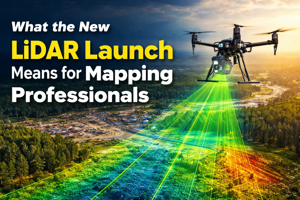
The new LiDAR systems being launched today are very different from older models. In the past, LiDAR units were large, heavy, and expensive. They were mostly used on airplanes or helicopters and required big teams to operate them. The new launch focuses on smaller, lighter, and smarter systems. Many of these new LiDAR sensors can now be mounted on drones, vehicles, or even handheld devices.
One of the biggest changes is speed. New LiDAR systems can collect millions of data points every second. This means more detail in less time. Another major improvement is accuracy. Even small objects, such as power lines or tree branches, can now be captured clearly. This level of detail was hard to achieve before without multiple survey passes.
Ease of use is another big improvement. Older LiDAR systems often required expert operators and complex software. New systems are designed to work with user-friendly software that automates many steps. This allows mapping professionals to focus more on analysis and decision-making rather than struggling with tools.
Performance and Technical Improvements
Performance is where this new LiDAR launch truly stands out. The range of modern LiDAR sensors has increased, allowing them to capture data from higher altitudes or longer distances. This is helpful for large-area mapping projects like highways, forests, or flood zones.
Resolution has also improved. Higher resolution means more points per square meter, which leads to more detailed maps and models. For professionals, this means fewer gaps in data and less need for re-surveys. Accuracy levels are also better, often reaching centimeter or even millimeter precision when used correctly.
Another important improvement is how these systems handle different environments. New LiDAR sensors work better in low light, fog, and uneven terrain. This makes them more reliable in real-world conditions where weather and landscape are unpredictable.
Implications for Mapping Professionals
For mapping professionals, this new LiDAR launch changes how work gets done from start to finish. Data collection is faster, which means projects can be completed in shorter timeframes. This is especially important for clients who need quick results, such as construction companies or emergency response teams.
Better data quality also means fewer mistakes. Clearer point clouds lead to better maps, which reduces the need for corrections later. This saves both time and money. Professionals can also take on more complex projects that were once too difficult or expensive.
Another major impact is competitiveness. Professionals who adopt new LiDAR technology early can offer better services than those using older methods. This can help win contracts and build stronger client relationships.
Use Cases and Industry Impact
The impact of this LiDAR launch can be seen across many industries. In urban planning, detailed 3D maps help city planners design better roads, buildings, and public spaces. In forestry, LiDAR helps measure tree height, canopy density, and forest health without cutting a single tree.
In infrastructure projects, such as bridges and railways, LiDAR data helps engineers spot problems early. This improves safety and reduces repair costs. Environmental monitoring also benefits, as LiDAR can track erosion, flooding, and land changes over time.
Each of these use cases shows how LiDAR is no longer just a tool for specialists. It is becoming a standard part of mapping and planning work across industries.
Benefits for Different Mapping Roles
Different roles within the mapping profession benefit in different ways from this new LiDAR launch. Surveyors can collect data faster and with fewer field visits. This reduces physical strain and improves safety, especially in dangerous areas.
GIS analysts receive cleaner and more detailed data, making analysis easier and more accurate. This leads to better reports and stronger insights. Remote sensing specialists benefit from improved data integration, as new LiDAR systems often work well with satellite and aerial imagery.
Project managers also gain advantages. Faster workflows mean better project timelines and happier clients. Improved accuracy reduces risk and helps projects stay within budget.
Challenges and Considerations
While the new LiDAR launch offers many benefits, it also comes with challenges. Cost is one of the main concerns. New LiDAR systems can be expensive, especially for small firms. However, the long-term savings from faster work and fewer errors often balance the initial investment.
Training is another consideration. Even though systems are becoming easier to use, professionals still need time to learn new tools and software. Firms must invest in training to get the full benefit.
Integration with existing workflows can also be a challenge. Not all software and hardware systems work smoothly together. Before adopting new LiDAR technology, professionals should check compatibility with their current tools.
Future Outlook for the Mapping Industry
Looking ahead, this LiDAR launch is likely just the beginning. As technology continues to improve, LiDAR systems will become even smaller, cheaper, and more powerful. Real-time data processing may soon become standard, allowing professionals to see results instantly in the field.
Artificial intelligence will also play a bigger role. AI can help classify objects, detect changes, and automate analysis. This will further reduce manual work and improve accuracy.
For mapping professionals, staying updated with these trends is important. Those who adapt early will be better prepared for future demands and opportunities.
Conclusion
The new LiDAR launch represents a major step forward for mapping professionals. It brings faster data collection, better accuracy, and more flexible workflows. While there are challenges such as cost and training, the benefits are clear and long-lasting.
For professionals who rely on accurate maps and timely data, adopting new LiDAR technology can improve efficiency, competitiveness, and project quality. As the mapping industry continues to evolve, LiDAR will remain a key tool shaping its future.
Read More Interesting and Informational Blogs Please Visit Our Website Lidarmos
Frequently Asked Questions (FAQs)
1. What is LiDAR and why is it important for mapping?
LiDAR is a technology that uses light pulses to measure distances and create detailed maps. It is important because it provides high accuracy and works well in many environments.
2. How does this new LiDAR launch help mapping professionals?
It helps by improving speed, accuracy, and ease of use, allowing professionals to complete projects faster and with better results.
3. Is the new LiDAR technology hard to learn?
Most new systems are designed to be user-friendly, but some training is still needed to use them effectively.
4. Can small mapping firms afford new LiDAR systems?
While initial costs can be high, many firms find that the long-term savings and increased productivity make it a good investment.
5. Will LiDAR replace traditional surveying methods?
LiDAR will not fully replace traditional methods, but it will continue to work alongside them and handle tasks that were once difficult or time-consuming.

