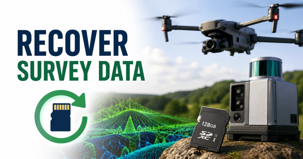
For drone surveyors and GIS professionals, losing critical survey data mid-project isn’t just frustrating — it can mean missed deadlines, repeat flights, and significant financial loss. LiDAR operators and mapping technicians store irreplaceable point cloud files, .las/.laz datasets, orthomosaic inputs, and raw sensor logs directly on SD cards during field operations. When that data disappears, the stakes are far higher than losing personal photos.
In 2026, recovery options have improved significantly — but the window for successful recovery is narrow, and the wrong move can make things permanent. This guide is written specifically for drone surveyors, GIS professionals, and mapping technicians who need to recover professional-grade survey data, not casual Mac users looking for lost vacation photos.
Can You Recover Deleted LiDAR or Drone Survey Files from an SD Card?
Yes — in most cases, deleted or corrupted survey files can be recovered, including .las, .laz, .tiff, .bag, and raw point cloud formats. When files are deleted or a card is formatted, the data isn’t immediately erased. The system simply marks that storage space as available. Until new data overwrites those sectors, recovery software can locate and restore the original files.
This is why the single most important rule after any data loss event in the field is: stop using the SD card immediately. Every new write — even a small log file — risks permanently overwriting your survey data.
Recovery success is generally high in these scenarios:
- Accidental deletion during file transfer at base camp
- Quick format performed by mistake
- Card corruption from power failure mid-flight
- SD card becoming unreadable after field exposure
- Lost partitions after improper ejection from flight controller
Recovery becomes difficult or impossible when:
- The SD card has physical damage from crash impact or water ingress
- New data has been written over the deleted files
- A secure erase was performed
- The card’s NAND memory has failed completely
Common Reasons for Drone/LiDAR Survey Data Loss in the Field
Understanding why field data loss happens helps prevent it — and helps you choose the right recovery method when it does.
Battery failure mid-flight is one of the most damaging causes. When a drone loses power during active LiDAR scanning, the SD card may be in the middle of writing a large .las file. An incomplete write corrupts the file header, making the entire dataset unreadable even though most of the point cloud data is still physically present on the card.
Card removal during active recording is another frequent culprit. In multi-sensor setups, technicians sometimes pull storage cards while a secondary system is still logging IMU or GPS data. This can corrupt the file allocation table, making all files on the card appear missing.
Dust and debris ingress in the field degrades SD card contacts over time, causing intermittent read failures that can progress to full card corruption. Desert mapping operations and construction site surveys are especially high-risk environments.
Vibration damage from long-duration flights can cause micro-fatigue in SD card connectors, particularly in UAVs without proper vibration dampening on their payload bays.
Accidental formatting during field data management — especially when operators are managing multiple cards across multiple flights — is more common than many teams admit. A quick format on the wrong card can appear to erase an entire flight’s worth of survey data.
File system incompatibility between the LiDAR sensor’s onboard system and the operator’s Mac can also cause cards to appear blank or unreadable, even when the data is intact.
What to Do Before Starting Recovery
Before touching any recovery software, follow these steps. They directly affect whether your point cloud data survives.
Stop all writes to the card immediately. Do not copy files to it, do not let the flight controller write logs to it, and do not attempt to repair it using the drone’s own software.
Remove the card and use a quality card reader. Connect the SD card directly to your Mac using a reliable USB card reader. Avoid cheap adapters — poor contact during scanning can cause read errors that look like data loss.
Do not reformat the card, even if your Mac or flight software prompts you to. Many operators make this mistake thinking a reformat will “fix” the card. It compresses the recovery window dramatically.
Create a disk image of the SD card before doing anything else. Use macOS Disk Utility or a command-line tool to clone the card sector-by-sector to a file on your workstation. All recovery attempts should be run against this image, not the original card. This protects your one chance at recovery.
Note the card’s condition and the circumstances of loss. Knowing whether the card was in active use during a crash, exposed to moisture, or simply ejected incorrectly helps you and any professional recovery service understand what you’re dealing with.
Best Methods to Recover Drone Survey & LiDAR Data from SD Cards
Method 1: Professional Data Recovery Software
Recovery software is the most accessible and effective first step for most field data loss scenarios. Modern tools perform deep sector-level scans and can reconstruct .las, .laz, GeoTIFF, and other survey file formats even when directory structures are damaged.
Recommended tools for drone/LiDAR data recovery:
- Disk Drill — Strong deep scan engine, Mac-friendly interface, supports a wide range of file signatures including geospatial formats
- EaseUS Data Recovery Wizard — Reliable for formatted card recovery and missing partition scenarios
- Stellar Data Recovery — Well-regarded for recovering large files and raw sensor data from damaged cards
- Wondershare Recoverit — Handles corrupted file systems effectively; useful when the card mounts but files appear missing
- PhotoRec — Free and open-source; technically powerful and works well for recovering files by signature, which is valuable when .las/.laz headers are damaged
These tools work well for recovering .las and .laz files, point cloud datasets, raw image captures from survey cameras, GeoTIFF outputs, flight logs, and GPS/IMU data files.
Recovery process:
- Install the recovery software on your Mac — never on the SD card itself
- Connect the SD card (or mount the disk image you created)
- Select the card from the device list and initiate a deep scan
- Filter results by file type — look for .las, .laz, .tiff, .jpg, .bin, or whatever formats your sensor generates
- Preview recoverable files where the software allows
- Save recovered files to a separate drive — never back to the original SD card
Most tools offer free scanning with paid recovery. Running the scan first to confirm your files are recoverable before purchasing is a reasonable approach.
Method 2: macOS Disk Utility First Aid
If your SD card becomes unreadable or throws file system errors, Disk Utility’s First Aid function can repair minor corruption without deleting data.
Open Disk Utility from Applications → Utilities, select your SD card from the sidebar, and click First Aid. The tool will check for file system errors and attempt automatic repair.
This is most useful when the card mounts but displays errors, or when files appear to be missing after an improper ejection. It is not a recovery tool on its own — if files have been deleted or the card is heavily corrupted, you will still need recovery software afterward.
Method 3: Terminal-Based Disk Repair
Advanced users can use Terminal commands like diskutil to repair file system structures or force an unresponsive SD card to mount. This is useful for cards that are recognized by the system but won’t mount through normal means.
This approach carries risk for users unfamiliar with command-line tools. If you’re not comfortable here, go directly to recovery software.
Method 4: Time Machine or Cloud Backup Restoration
If your field workflow includes syncing data to a backup drive or cloud storage before leaving the site, Time Machine or your backup system may have a copy of the lost files. This is the fastest and cleanest recovery method — but it only works if backups were current at the time of loss.
Best Practices for Drone/LiDAR Field Data Backup
Prevention is always preferable to recovery. These practices are specifically designed for surveyors and mapping technicians operating in the field.
Use the 3-2-1 rule adapted for field work. Keep three copies of every dataset: the original on the SD card, a field backup on a rugged external drive at base camp, and an offsite or cloud copy uploaded at the end of each survey day. Many teams skip the second step during busy field schedules — that’s when single-card failures become disasters.
Transfer data before re-flying. Make it a hard rule: never reuse an SD card for a second flight until the first flight’s data has been confirmed transferred and verified on a separate drive. Verification means opening the files, not just checking that they copied.
Use industrial-grade SD cards rated for vibration and temperature. Consumer SD cards are not designed for the operating environment inside a UAV payload bay. Cards rated for industrial use (look for operating temperature ranges of -40°C to 85°C and vibration tolerance specs) are significantly more reliable.
Eject cards properly every time. Always use your flight controller’s proper shutdown sequence before removing the SD card. Never pull a card while the system is powered. Post-flight checklists should include “confirm SD card safe to remove” as an explicit step.
Enable real-time data mirroring where hardware allows. Some LiDAR systems support dual-card recording or simultaneous transmission of data to a ground station during flight. If your hardware supports this, use it for critical surveys.
Carry a field recovery kit. Keep a portable card reader, a laptop preloaded with recovery software (licensed and tested), and a backup drive at base camp. If data loss happens in a remote location, you want to be able to begin recovery immediately rather than waiting to return to the office.
Label and log every card. Use a physical labeling system and a flight log that records which card was in which sensor for which flight. In multi-sensor, multi-flight operations, card confusion is a real cause of accidental formatting.
Frequently Asked Questions
Can .las and .laz files be recovered after SD card corruption?
Yes. Recovery software scans by file signature, meaning it can locate and reconstruct .las and .laz files even when the file system directory is damaged. Success depends on whether the data sectors themselves are intact.
My flight controller formatted the SD card automatically after a crash. Can I still recover the data?
Quick formatting typically removes the directory but leaves data sectors intact. Stop using the card, create a disk image, and run a deep scan with recovery software as soon as possible.
How long does a deep scan of a large LiDAR data card take?
For a 256GB card with dense point cloud data, a full deep scan can take two to six hours depending on the software and your Mac’s read speed. Plan accordingly and do not interrupt the scan.
Is free recovery software reliable for professional survey data?
PhotoRec is a legitimate open-source tool used by professionals. For .las/.laz recovery specifically, testing a licensed tool’s free scan before committing to purchase is a reasonable approach. Avoid unknown free tools downloaded from unfamiliar sites.
Conclusion
For drone surveyors and LiDAR operators, SD card data loss is a field reality — but it doesn’t have to mean permanent data loss. Acting quickly, avoiding any new writes to the card, creating a disk image before recovery attempts, and using professional recovery software gives you the best possible chance of restoring your point cloud files, survey imagery, and flight logs.
The methods in this guide — recovery software, Disk Utility First Aid, and Terminal-based repair — give you a structured path from data loss to recovery. But the more durable solution is building a field backup protocol that makes single-card failure a minor inconvenience rather than a project-ending event.
This is especially critical for professionals running large-scale mapping operations — see our guide on LiDAR Drone Mapping for a deeper look at how to structure data workflows that protect your survey data from collection to delivery.

Technology writer and researcher passionate about LiDAR, robotics, and AI systems. Through Lidarmos, I share in-depth guides and insights to make cutting-edge sensing technology accessible to everyone.