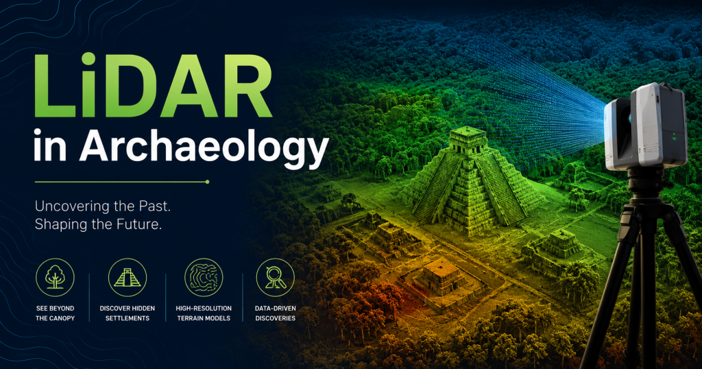
In 2018, a team of archaeologists flew a laser-equipped aircraft over 2,100 square kilometers of Guatemalan jungle. What they found shattered everything historians thought they knew about the ancient Maya civilization. Beneath an unbroken canopy of tropical forest, their LiDAR sensors revealed more than 60,000 previously unknown structures — pyramids, palaces, roads, irrigation systems, and defensive walls — belonging to a civilization far larger, more complex, and more interconnected than anyone had imagined.
It was, in the words of the researchers, the most significant archaeological discovery in the Maya region in over a century. And it happened not through years of jungle exploration, but through a single aerial survey using laser technology originally developed for military mapping and autonomous vehicles.
This is what LiDAR archaeology can do — and it is not just happening in Guatemala. From Cambodia to Bolivia, from Honduras to Italy, laser scanning is rewriting the history of ancient civilizations around the world by revealing cities, roads, temples, and entire urban networks that have been hidden for centuries beneath vegetation, soil, and time. In my view, it is the most exciting application of LiDAR technology because it does not just serve the future — it recovers the past.
What is LiDAR? LiDAR (Light Detection and Ranging) fires pulses of laser light and measures how long they take to bounce back, creating precise 3D maps.
The Science: How LiDAR Sees Through Jungle Canopy
The interesting thing about LiDAR archaeology is that the technology was not designed for finding ancient cities. It was developed for topographic mapping, autonomous vehicle navigation, and engineering surveys. The archaeological application came from a simple but brilliant insight: laser pulses are small enough to pass through tiny gaps in a jungle canopy, and when they do, they bounce off whatever is on the ground beneath.
Multiple Returns — The Key Mechanism
When a LiDAR sensor fires a laser pulse at a dense forest, most of the light hits the top layer of leaves and branches and reflects straight back — that is the first return. But some pulses — maybe 10 to 30 percent, depending on how dense the canopy is — find small gaps between leaves and branches and continue downward. Some of these hit a sub-canopy layer of smaller vegetation and return as a second return. And a smaller fraction continue all the way to the ground itself, returning as the last or ground return.
A modern airborne LiDAR sensor recording all returns from a single pulse can therefore capture the full vertical structure of a forest in a single measurement: the canopy top, the mid-story, and the ground — simultaneously. This multi-return capability is what makes LiDAR so transformative for archaeology.
Ground Filtering Software
The raw LiDAR data from a jungle survey is a chaotic cloud of billions of points representing tree tops, branches, leaves, and ground in an undifferentiated mass. The archaeologically interesting information is only in the ground returns — perhaps 5 to 15 percent of the total data. Ground filtering algorithms — software tools that classify each point as vegetation or ground based on its height relative to neighboring points — isolate the ground returns and discard everything else.
The result is a Digital Terrain Model (DTM): a precise 3D map of just the bare ground surface, as if every tree and plant had been magically removed. And on that bare ground surface, the footprints of ancient structures emerge with startling clarity. A pyramid that has been buried under centuries of jungle growth appears as a perfectly regular stepped mound. A Maya road shows up as a raised linear feature cutting arrow-straight across rolling terrain. Irrigation canals reveal themselves as branching linear depressions.
Diagram 1: How LiDAR ‘Strips Away’ the Jungle Canopy
WHAT A CAMERA OR SATELLITE SEES:
───────────────────────────────────────────────────────
~~~~~~~~~~~~~~~~~~~~~~~~~~~~~~~~~~~~~~~~~~~~~~~~~~~~
~~~~ DENSE JUNGLE CANOPY (100% obstruction) ~~~~~
~~~~~~~~~~~~~~~~~~~~~~~~~~~~~~~~~~~~~~~~~~~~~~~~~~~~
[Everything below is completely invisible]
WHAT LIDAR SEES (multiple laser returns):
───────────────────────────────────────────────────────
~~~~~~~~~~~~~~~~~~~~~~~~~~~~~~~~~~~~~~~~~~~~~~~~~~~~
~~~~ JUNGLE CANOPY (Return #1 — tree tops) ~~~~~
~~~~~~~~~~~~~~~~~~~~~~~~~~~~~~~~~~~~~~~~~~~~~~~~~~~~
| | | | |
| gaps in foliage allow pulses through
| | | | |
…. sub-canopy vegetation (Return #2) …………
| | | | |
v v v v v
══════════════════════════════════════════════════
██ [PYRAMID] ██████ [WALL] █ [ROAD] █ GROUND
══════════════════════════════════════════════════
[Return #3 = GROUND — reveals hidden structures!]
Software filters out Returns #1 and #2.
Only Return #3 (ground) remains = bare earth model.
Ancient city becomes visible.
Diagram 1: LiDAR’s multiple-return capability penetrates jungle canopy to reveal ground features below
What LiDAR Can and Cannot Detect
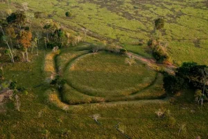
LiDAR archaeology is powerful but not unlimited. It excels at detecting surface and near-surface features with vertical relief — anything that creates a bump, ridge, depression, or flat platform on the ground surface. This includes pyramids, platform mounds, defensive earthworks, roads, plazas, field boundaries, irrigation systems, and building foundations.
What LiDAR cannot do is see underground. A buried chamber filled with artifacts at two meters depth leaves no surface expression and is invisible to LiDAR. Features that have been completely flattened by centuries of erosion may also be below the detection threshold. This is why LiDAR is the beginning of archaeological discovery, not the end — it shows researchers where to dig, but the excavation work still requires human hands and traditional archaeological methods.
Image Suggestion (alt text): Add image here: “LiDAR archaeology ground filtering before after jungle Guatemala” — Free on Wikimedia Commons: search “Caracol LiDAR” or “PACUNAM LiDAR initiative”. Alt text: “LiDAR archaeology scan showing hidden Maya city beneath jungle canopy Guatemala”
The Maya Revolution: How LiDAR Rewrote History
No region on Earth has been more transformed by LiDAR archaeology than the Maya lowlands of Central America. The Maya civilization has been studied for over 150 years, and archaeologists thought they had a reasonably good picture of its extent and complexity. LiDAR proved that picture was profoundly incomplete.
Caracol — The First Major Revelation (2010)
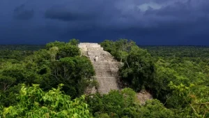
The story of LiDAR in Maya archaeology begins at Caracol, an ancient Maya city in Belize that had been excavated by archaeologists Arlen and Diane Chase for decades. They knew it was a large and important city — but the jungle made it nearly impossible to understand its full extent. In 2010, they flew an early airborne LiDAR system over 200 square kilometers of jungle around Caracol and processed the data.
What emerged was astonishing. In a single week of data processing, the LiDAR survey revealed more about Caracol’s layout than 25 years of ground-based fieldwork. The data showed an intricate network of causeways — raised roads connecting different parts of the city — agricultural terracing on hillsides that fed tens of thousands of people, reservoirs and water management systems, and residential neighborhoods extending far beyond what anyone had suspected. The city was enormous — one of the largest Maya capitals — and its agricultural and infrastructure systems were far more sophisticated than its jungle-covered ruins had suggested.
🏛 DISCOVERY: Caracol, Belize (2010)
200 km² surveyed in one flight. Revealed 77,000+ structures including terraced agriculture, causeways, and water systems previously unknown. 25 years of ground survey was surpassed in one week of LiDAR data processing.
The PACUNAM Survey — Rewriting an Entire Civilization (2018)
The Caracol survey was remarkable, but it was a preview of what was coming. In 2018, the PACUNAM LiDAR Initiative — a consortium of archaeologists from universities across the United States, Europe, and Guatemala — published results from a 2,100 square kilometer aerial LiDAR survey of the northern Petén region of Guatemala, one of the heartlands of ancient Maya civilization.
The numbers were staggering. The survey identified more than 61,000 previously unknown archaeological structures — not small objects, but buildings, platforms, plazas, and infrastructure elements. The data suggested that the Maya lowlands had been home to between 7 and 11 million people at the civilization’s peak in the Classic period (250–900 CE) — two to three times higher than previous estimates based on visible sites alone.
More importantly, the LiDAR data revealed that Maya cities were not isolated settlements surrounded by empty jungle. They were nodes in a dense, interconnected network — connected by hundreds of kilometers of raised roads (sacbeob), sharing water management infrastructure, and organized according to a coherent regional urban plan that archaeologists had never been able to perceive because no one had ever been able to see the entire landscape at once.
🏛 DISCOVERY: PACUNAM LiDAR Initiative, Guatemala (2018)
2,100 km² surveyed. 61,480 previously unknown structures identified. Population estimate for Classic Maya period revised upward to 7–11 million. Revealed Maya civilization as a densely networked urban society, not scattered independent city-states.
The Lost City of the Monkey God, Honduras (2015)
In 2015, a team of archaeologists and filmmakers flew a LiDAR survey over an unexplored valley in Honduras’s Mosquitia region — an area of dense jungle so remote and dangerous that it had largely resisted exploration for decades. The LiDAR data revealed the outlines of a complete, previously unknown city — plazas, pyramids, earthworks, and what appeared to be a sophisticated urban layout — belonging to a civilization that had no name in historical records.
The discovery made international headlines and was subsequently confirmed by ground teams who entered the jungle and found the city intact — untouched by looters precisely because it had been completely unknown. The site contained remarkable artifacts, including a cache of ritual objects that had been undisturbed for approximately 500 years. Without LiDAR, this city might never have been found, or might have taken decades more of hazardous jungle exploration to locate.
Angkor Wat and the Khmer Empire: The Largest Pre-Industrial City
Cambodia’s Angkor Wat is the largest religious monument ever built — a fact long known to archaeologists. What was not known, until LiDAR surveyed the surrounding jungle, was that Angkor Wat was the centerpiece of a metropolitan area that dwarfs any pre-industrial city in recorded history.
Damian Evans and the Greater Angkor Survey
Australian archaeologist Damian Evans led a series of airborne LiDAR surveys of the Angkor region beginning in 2012, eventually covering over 2,000 square kilometers of Cambodian jungle and farmland surrounding the famous temple complexes. The results fundamentally changed our understanding of the Khmer Empire, one of the most powerful civilizations of medieval Southeast Asia (802–1431 CE).
The LiDAR data revealed that the temples of Angkor were not freestanding religious monuments in a lightly settled landscape. They were the symbolic and administrative core of a vast, densely populated metropolitan area covering more than 1,000 square kilometers — with an estimated population of 750,000 to 900,000 people at its peak. The surrounding landscape was covered with a grid of rice paddies, water management canals, residential neighborhoods, and connecting roads that had been invisible beneath the jungle for six centuries.
Diagram 3: Before and After LiDAR — Angkor Wat Region Example
BEFORE LIDAR (what archaeologists knew):
────────────────────────────────────────────
┌──────────────────────────────┐
│ Angkor Wat Temple [known] │
│ Angkor Thom City [known] │
│ ~10 sq km mapped │
│ Population: 70,000 est. │
│ Dense jungle: unexplored │
└──────────────────────────────┘
AFTER LIDAR (Damian Evans survey, 2012-2015):
────────────────────────────────────────────
┌──────────────────────────────────────────────────┐
│ Angkor Wat + Angkor Thom [still known] │
│ + Mahendraparvata [1,200 yr old city] │
│ + Entire water mgmt network [734 sq km canals] │
│ + Urban grid beyond temples [1,000 sq km+] │
│ + Beng Mealea connections [new road network] │
│ Population revised: 750,000 – 900,000 │
│ Size: LARGEST pre-industrial city ever found │
└──────────────────────────────────────────────────┘
LiDAR increased known extent of Angkor by 10x in one flight.
Diagram 3: What LiDAR revealed about Angkor — a city ten times larger than previously known
Mahendraparvata — A Lost Capital Rediscovered
One of the most dramatic discoveries from the Angkor LiDAR surveys was the identification of Mahendraparvata, a city on Phnom Kulen mountain that historical records identified as an early Khmer capital but that had never been located with precision. The LiDAR data revealed a complete planned city grid — streets laid out in a regular pattern, temple platforms, water features, and a sophisticated urban plan — hidden beneath dense forest on the mountain plateau.
Ground expeditions following the LiDAR survey confirmed the city’s existence and extent, finding temple foundations, inscriptions, and artifacts consistent with a major Khmer administrative center dating to the 9th century CE. The city had been abandoned approximately 1,200 years ago and reclaimed entirely by jungle.
🏛 DISCOVERY: Greater Angkor, Cambodia (2012–2015)
Revealed Angkor as the largest pre-industrial city in history — 1,000+ km², population 750,000–900,000. Found the lost capital of Mahendraparvata. Mapped 734 km² of water management canals. Rewrote understanding of Khmer Empire’s scale and sophistication.
The Amazon: Lost Civilizations Under the Rainforest
For decades, the dominant view among anthropologists was that the Amazon basin — while diverse in indigenous peoples — had never supported large, complex civilizations. The dense jungle and poor soils, the argument went, could not sustain the agricultural surpluses needed for urbanization. LiDAR is dismantling this view systematically.
The Casarabe Culture — An Amazon Urban Network
In 2022, a landmark study published in Nature revealed the results of LiDAR surveys over the Llanos de Mojos region of Bolivia’s Amazon. The data revealed 26 previously unknown settlement sites belonging to the Casarabe culture (500–1400 CE), connected by a network of raised roads and canals stretching across hundreds of kilometers. Two sites were identified as large urban centers, each covering several square kilometers with monumental earthworks, elevated platforms, and sophisticated water management features.
The discovery proved that complex urban civilization did exist in the Amazon before European contact — and that it had been completely invisible to researchers because it was hidden beneath the jungle and had no above-ground stone architecture to attract attention. The Casarabe people built in earth rather than stone, and their cities had been absorbed back into the landscape so completely that ground survey had missed them entirely.
Brazilian Geoglyphs — 2,000 Years of Hidden History
Earlier LiDAR surveys in the Brazilian Amazon had revealed something equally surprising: over 450 geometric earthworks — circles, squares, and complex polygons — cut into the landscape across an area of 13,000 square kilometers in the state of Acre. These geoglyphs, dated to between 100 BCE and 1500 CE, were made by a pre-Columbian civilization that archaeologists knew almost nothing about.
The geoglyphs vary in size from 100 to 300 meters across and were clearly made with significant engineering effort and social organization. Many appear to be ritual or ceremonial enclosures rather than defensive works or residential sites. Their sheer number — 450 known sites, with researchers estimating thousands more may await discovery — suggests a population and level of territorial organization in the pre-contact Amazon that no one suspected.
Beyond the Jungle: LiDAR Archaeology in Other Environments
While jungle discoveries grab the most attention, LiDAR archaeology is transforming our understanding of ancient sites in environments around the world — from English fields to Italian hillsides.
Stonehenge — A Landscape Full of New Monuments
In 2014, the Stonehenge Hidden Landscapes Project — using ground-based and airborne LiDAR combined with other remote sensing technologies — revealed 17 previously unknown monuments in the landscape surrounding Stonehenge. These included burial mounds, pits, and what appeared to be a large wooden structure that predated Stonehenge itself. The discoveries suggested that the area around Stonehenge was far more intensively used and ritually significant than the famous stone circle alone had indicated.
Falerii Novi — A Roman City in Perfect Detail
In 2020, researchers from the University of Cambridge and Ghent University used ground-penetrating radar combined with LiDAR survey to map an entire Roman city called Falerii Novi in central Italy — without excavating a single trench. The survey revealed the city’s complete street grid, a forum, temples, market buildings, a bath complex, and residential neighborhoods. One particularly striking discovery was a large public monument near the city’s north gate that was unlike anything previously documented in Roman architecture.
The Falerii Novi survey represents what many archaeologists see as the future of their discipline: non-invasive, complete characterization of buried cities that allows researchers to understand an entire urban layout before deciding where to focus limited excavation resources.
Bagan, Myanmar — Rethinking a Sacred Landscape
The ancient temple city of Bagan in Myanmar — home to over 2,000 surviving Buddhist pagodas — was surveyed with LiDAR in 2019. The results revealed that the surviving pagodas, impressive as they are, represent only a fraction of the original city’s extent. The LiDAR data showed evidence of a large, planned urban grid with residential neighborhoods, markets, and administrative buildings extending well beyond the ceremonial core — suggesting Bagan was a much more complex and populous city than its monumental religious architecture alone had suggested.
Diagram 2: Major LiDAR Archaeology Discoveries by Region
REGION DISCOVERY YEAR SCALE
──────────────────────────────────────────────────────────────────
Guatemala (Maya) Caracol city network 2010 77,000+ structures
Guatemala (Maya) PACUNAM survey, 60,000 sites 2018 2,100 km2 surveyed
Honduras Lost City of the Monkey God 2015 Entirely unknown city
Belize Caracol ancient Maya capital 2010 Largest Maya survey
Cambodia Greater Angkor network 2012 Largest pre-industrial city
Cambodia Mahendraparvata temple city 2013 1,000 yr old lost capital
Amazon, Brazil Geoglyphs under rainforest 2017 450+ earthworks
Amazon, Bolivia Casarabe mound network 2022 26 urban centers found
Myanmar Bagan temple surroundings 2019 New urban plan revealed
Italy Falerii Novi Roman city 2020 Forum, temple, market
Mexico (Maya) Aguada Fénix platform 2020 Largest Maya structure
England Stonehenge surroundings 2014 17 new monuments found
Total estimated hidden structures found via LiDAR archaeology: 500,000+
Diagram 2: Global timeline of major archaeological discoveries made using LiDAR technology
LiDAR vs Traditional Archaeology: A Complete Comparison
To understand why LiDAR has been so transformative, it helps to see the numbers directly side by side:
| Comparison Point | Traditional Archaeology | LiDAR Archaeology |
| Survey speed | 1–5 acres/day on foot | 500–5,000 acres per flight hour |
| Dense jungle access | Often impossible; dangerous | Full coverage regardless of terrain |
| Structures found | Only what eyes can see | All ground-level features ≥50cm height |
| Coverage depth | Surface walk only | Multiple laser returns = under-canopy |
| Team size needed | 5–30 field archaeologists | 1 pilot + 1 data analyst |
| Cost per km² | $50,000–$200,000 (jungle survey) | $500–$5,000 per km² (aerial LiDAR) |
| Accuracy | Manual sketch maps; ±2–5 m | Digital elevation model; ±5–15 cm |
| Site disturbance | Vegetation clearing required | Zero — completely non-invasive |
| Data permanence | Field notes; photos; hand maps | Digital 3D point cloud; permanent |
| Discoverable features | Visible mounds and walls only | Roads, canals, field systems, plazas |
| Night / rain work | No | Yes — LiDAR is weather independent |
| Hidden city discovery | Requires years of fieldwork | Can reveal in a single 2-hour flight |
Table 1: LiDAR archaeology vs traditional ground-survey methods — speed, coverage, cost, and capability
The comparison is not meant to suggest that traditional archaeology is obsolete — excavation, artifact analysis, dating, and interpretation all require the kind of careful human attention that LiDAR cannot provide. But for the initial discovery and mapping phase — finding and delineating sites across large areas of difficult terrain — LiDAR has no equal.
Personal observation: What strikes me most about the LiDAR archaeology revolution is not just the scale of what has been found, but how it changes the questions archaeologists can ask. When you can see an entire civilization’s road network in one image, you start asking not ‘what is this site?’ but ‘how did this whole society function?’ That shift from site-level to landscape-level thinking is perhaps the most profound change LiDAR has brought to archaeology.
How Archaeologists Actually Use LiDAR Data
Understanding how archaeologists work with LiDAR data from survey to discovery helps explain both its power and its limitations.
The Survey Flight
A typical archaeological LiDAR survey involves a small aircraft or large drone flying a pre-programmed grid pattern over the target area at an altitude of 500 to 2,000 meters. A rotating or scanning LiDAR sensor fires up to 2.4 million pulses per second downward, and the aircraft’s GPS and IMU (Inertial Measurement Unit) record its precise position and orientation at every moment. A single four-hour flight can survey 500 to 1,000 square kilometers of terrain.
The raw data from one flight might consist of 5 to 50 billion individual laser return measurements, each tagged with precise 3D coordinates. This data volume — often hundreds of gigabytes — requires powerful computers and specialized software to process.
Data Processing and Filtering
Ground filtering is the most critical processing step. Software algorithms — the most widely used are based on the work of Martin Isenburg’s LAStools suite and open-source packages like PDAL and CloudCompare — classify each point as ground or vegetation based on geometric criteria: ground points tend to be locally lowest, while vegetation points cluster above them. After filtering, the ground points are interpolated into a smooth Digital Terrain Model (DTM) raster at resolutions of 20 to 50 centimeters per pixel.
Visualization is then key. Raw DTMs often show subtle topographic features poorly. Archaeologists use a technique called hillshade rendering — simulating low-angle sunlight from multiple directions — to bring out small elevation differences that represent ancient structures. Another widely used visualization is the Sky View Factor, which highlights subtle terrain features by calculating how much of the sky is visible from each point. These visualizations are what make buried pyramids suddenly pop out of the data as clear, recognizable shapes.
From Data to Discovery to Excavation
After processing, archaeologists systematically scan the DTM visualizations — often covering thousands of square kilometers of data — looking for patterns that indicate human activity: regular geometric shapes (plazas and platforms), linear features (roads and walls), and clusters of mounds (building complexes). The identification process combines pattern recognition with deep knowledge of the local culture’s architectural traditions.
Once candidate sites are identified in the LiDAR data, fieldwork begins. Ground teams visit the GPS coordinates of identified features to confirm their existence, collect surface artifacts for dating, and assess the site’s condition and significance. Only the most significant sites receive full excavation — a resource-intensive process that the LiDAR survey has now informed with far more precision than was previously possible.
The Future of LiDAR Archaeology
The discoveries made so far — remarkable as they are — may represent only the beginning of what LiDAR will reveal about the ancient world.
Areas Not Yet Surveyed
Large portions of the world’s archaeological landscapes have never been surveyed with LiDAR. The Congo Basin, much of mainland Southeast Asia outside Cambodia, large areas of South and Central America, and most of Africa remain either unsurveyed or only partially covered. Each of these areas contains ancient cultures about which we know relatively little — and which almost certainly contain archaeological sites hidden by jungle cover comparable to what has been found in Guatemala and Cambodia.
The pace of surveying is increasing as sensor costs fall and as national heritage agencies, universities, and international bodies fund larger and more systematic survey programs. The PACUNAM model — a consortium of institutions sharing data and costs across a defined geographic region — is being replicated elsewhere.
Drone LiDAR for Site-Level Work
While large aircraft survey large areas, small drones with LiDAR are increasingly being used for detailed mapping of known archaeological sites. A drone can fly at 30 to 50 meters altitude over a known site and produce centimeter-resolution elevation models that reveal details invisible in aircraft data — individual stone courses in a wall, the precise dimensions of a doorway, the subtle slope of a platform’s surface. This capability is being used to document and monitor fragile sites, track looting damage, and plan precise excavation strategies.
For researchers interested in the technical side of drone LiDAR systems, our Low-Cost LiDAR Drone Build Guide at Lidarmos.com explains how to build a capable drone LiDAR system for archaeological documentation on a limited budget.
AI-Assisted Feature Detection
The biggest bottleneck in LiDAR archaeology is not data collection — it is analysis. A survey of 2,000 square kilometers produces so much data that even a large team of archaeologists takes months to review it thoroughly. Machine learning algorithms trained to recognize archaeological feature patterns — mounds, platforms, linear earthworks, enclosure geometries — are being developed that can scan LiDAR data automatically and flag candidate features for human review.
Early results from groups at the University of Leeds, Harvard, and several European archaeological institutes suggest that AI-assisted detection can identify 80 to 90 percent of manually-detectable features, with the remaining 10 to 20 percent missed due to poor preservation or unusual feature types. As training datasets grow and algorithms improve, automated detection will allow the systematic scanning of far larger areas than human-only review makes practical.
Frequently Asked Questions About LiDAR Archaeology
What is LiDAR archaeology?
LiDAR archaeology is the use of airborne laser scanning technology to detect and map ancient structures hidden beneath forest cover, vegetation, or centuries of soil buildup. A drone or aircraft fires millions of laser pulses at the ground, measures their return times to calculate precise 3D coordinates, and software filters away vegetation to reveal the bare earth surface — including walls, platforms, roads, canals, and buildings that have been invisible to human eyes for hundreds or thousands of years.
How does LiDAR find hidden cities in the jungle?
LiDAR sensors fire laser pulses that can pass through small gaps in the jungle canopy. Many pulses hit the tree tops and return immediately (first return), but a percentage of pulses pass through gaps in the foliage and reach the ground (last return). Software called ground filtering separates the ground returns from the vegetation returns and builds a Digital Terrain Model — a precise map of the bare ground surface. Ancient structures like pyramids, walls, and plazas create subtle raised or depressed features in this terrain model that archaeologists can then identify and investigate
What civilizations have been discovered using LiDAR?
LiDAR has transformed our understanding of several ancient civilizations. Maya cities in Guatemala, Belize, Honduras, and Mexico have been the biggest story — the 2018 PACUNAM survey alone revealed over 60,000 previously unknown structures across 2,100 square kilometers. In Cambodia, LiDAR revealed that the Khmer Empire’s Angkor complex was actually the largest pre-industrial city in history, covering over 1,000 square kilometers. In Bolivia’s Amazon, the Casarabe culture’s network of 26 interconnected urban centers was discovered in 2022. In Brazil, over 450 geometric earthworks made by pre-Columbian peoples were found beneath the Amazon rainforest.
Is LiDAR archaeology expensive?
Compared to traditional ground-survey archaeology in dense jungle environments, LiDAR is dramatically cheaper per square kilometer. A traditional jungle archaeological survey of one square kilometer can cost $50,000 to $200,000 and take months of dangerous fieldwork. An aerial LiDAR survey of the same area costs approximately $500 to $5,000 and takes minutes of flight time. The main costs are the aircraft or drone charter, the LiDAR sensor system rental or ownership, and specialist data processing. Large academic and government surveys covering hundreds of square kilometers have been conducted for $200,000 to $2 million — covering areas that would have taken decades and hundreds of millions of dollars to survey by traditional methods.
Can LiDAR find things underground?
Standard airborne LiDAR cannot see underground — it maps the surface of the ground with high precision, not what is beneath it. However, it is extremely good at detecting very subtle surface expressions of underground features: a buried wall might cause a slight linear rise in ground level of just 20 to 30 centimeters; a filled-in ditch leaves a subtle linear depression. LiDAR is sensitive enough to detect these micro-topographic features that are completely invisible to the human eye on foot. For true subsurface investigation, archaeologists use ground-penetrating radar (GPR), electrical resistivity tomography, or targeted excavation after LiDAR has identified the most promising areas.
Conclusion: Lasers Are Rewriting History
In the span of roughly fifteen years — from the first experimental LiDAR surveys at Caracol in 2010 to the ongoing systematic surveys of the Amazon, Southeast Asia, and Central America today — a single technology has fundamentally changed what we know about the ancient world. Cities that scholars debated in the abstract are now visible in precise 3D detail. Civilizations that history considered small and simple have been revealed as large, complex, and interconnected. Landscapes that appeared to be empty jungle have been shown to contain the remains of millions of ancient lives.
The interesting thing — the thing I keep returning to — is that none of these cities were hidden by accident or catastrophe. They were hidden simply by time and vegetation. They have been there, under the jungle, for hundreds or thousands of years, waiting for a technology precise enough to find them without removing the trees. LiDAR, developed for self-driving cars and drone navigation, turned out to be that technology.
We are likely still in the early phases of what LiDAR will reveal about the ancient world. The areas not yet surveyed are vast. The AI tools to automate detection are still maturing. And the archaeologists and historians who will spend the next decades excavating, dating, and interpreting what the lasers have found have barely begun their work.
The past is larger than we knew. LiDAR is how we are finding it.
To understand the technology behind these discoveries at a deeper technical level, see our complete guide How Does LiDAR Work? Step-by-Step at Lidarmos.net. For the companies building next-generation LiDAR systems that may power future archaeological surveys, see our Top LiDAR Startups 2025 article.

Technology writer and researcher passionate about LiDAR, robotics, and AI systems. Through Lidarmos, I share in-depth guides and insights to make cutting-edge sensing technology accessible to everyone.

